At a Glance
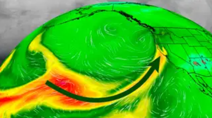
A powerful storm off the Northwest coast is dragging in an atmospheric river of moisture.
Strong winds have already hammered Washington and parts of Oregon and Northern California.
Heavy rain could trigger flooding, mudslides and rockslides, especially in Northern California and southwest Oregon.
Feet of snow will pile up in higher elevations.
Sign up for the Morning Brief email newsletter to get weekday updates from The Weather Channel and our meteorologists.
A “bomb cyclone” has become one of the northeast Pacific’s strongest storms on record, resulting in damaging winds across the Pacific Northwest overnight.
This storm’s impacts aren’t done yet, however, since it is also hauling in a strong, long-duration atmospheric river to the region, which is likely to produce flooding rain and feet of mountain snow.
The storm easily met the criteria for what meteorologists call bombogenesis, from where the term “bomb cyclone” originates. That means its pressure dropped by 24 or more millibars in 24 hours or less. This storm more than doubled that criteria.
Its estimated pressure dropped as low as 942 millibars, according to 10 p.m. EST analysis from NOAA’s Weather Prediction Center. That’s pretty much on par with an October 2021 storm (942.5 millibars) for the lowest pressure in about 50 years of records for the northeast Pacific region. Since these are estimates, there is some uncertainty in the exact pressures.
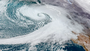
Because of that extreme intensity, the storm brought high winds to the Pacific Northwest overnight. More than 600,000 homes and businesses in Washington had lost power as of 2 a.m. PST, according to poweroutage.us. There have been multiple reports of trees down in western Washington, the National Weather Service said.
You can see where the storm is now along the Northwest coast in the current radar, satellite and surface pressure snapshot below.
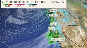
The system is also hauling in a long-lasting atmospheric river moisture plume packed with copious amounts of rain and mountain snow, especially in Northern California and parts of Oregon.
Peak impacts from this soaking pattern will unfold through Friday.
Breaking Down The Impacts
Heavy Rain – The biggest rainfall totals through the end of the workweek will take aim at Northern California (north of the Bay Area) into southwest Oregon. Some areas could pick up 8 to 12 inches of rain (locally up to 15 inches) in this region.
The heavy rain will result in flooding for poor drainage areas as well as possible flooding on creeks and rivers. Mudslides could be a threat too, especially in any recent wildfire burn areas. Rockslides are also possible along some mountain roads.
A rare high-risk excessive rainfall outlook has been issued by NOAA’s Weather Prediction Center in northwest California on Thursday, including Eureka, because of how serious the flood threat could be in that area.
Elsewhere, totals of 1 to 5 inches will extend northward through the rest of western Oregon and western Washington, with the heaviest amounts in coastal and foothill locations.
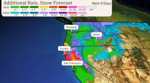
Snowfall – With moisture funneling into the Northwest day after day, snow will be measured in feet from the higher elevations of the Cascades southward into the Siskiyou and Sierra mountains of Northern California. Snow levels will rise through the week, but travel will still be impacted in some passes.
Snowfall and strong winds at times will impact Washington’s Snoqualmie Pass along Interstate 90 and Siskiyou Pass along Interstate 5 near the Oregon and California border.
The National Weather Service has issued various winter weather alerts from the Cascades to California’s northern Sierra. That includes a blizzard warning in the Washington Cascades into late Wednesday morning, where travel is highly discouraged.
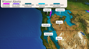
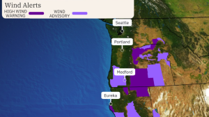
High Winds – The strongest bout of winds from this stormy pattern arrived late Tuesday in western Washington, western Oregon and North California. Winds should lessen in many of these areas on Wednesday.
There could be another bout of stronger winds arriving by early Friday, but regardless, winds will be gusty at times the rest of this week.
Chris Dolce has been a senior meteorologist with weather.com for over 10 years after beginning his career with The Weather Channel in the early 2000s.
